


Khabarovsk Krai Profile
LOCATION & GEOGRAPHY
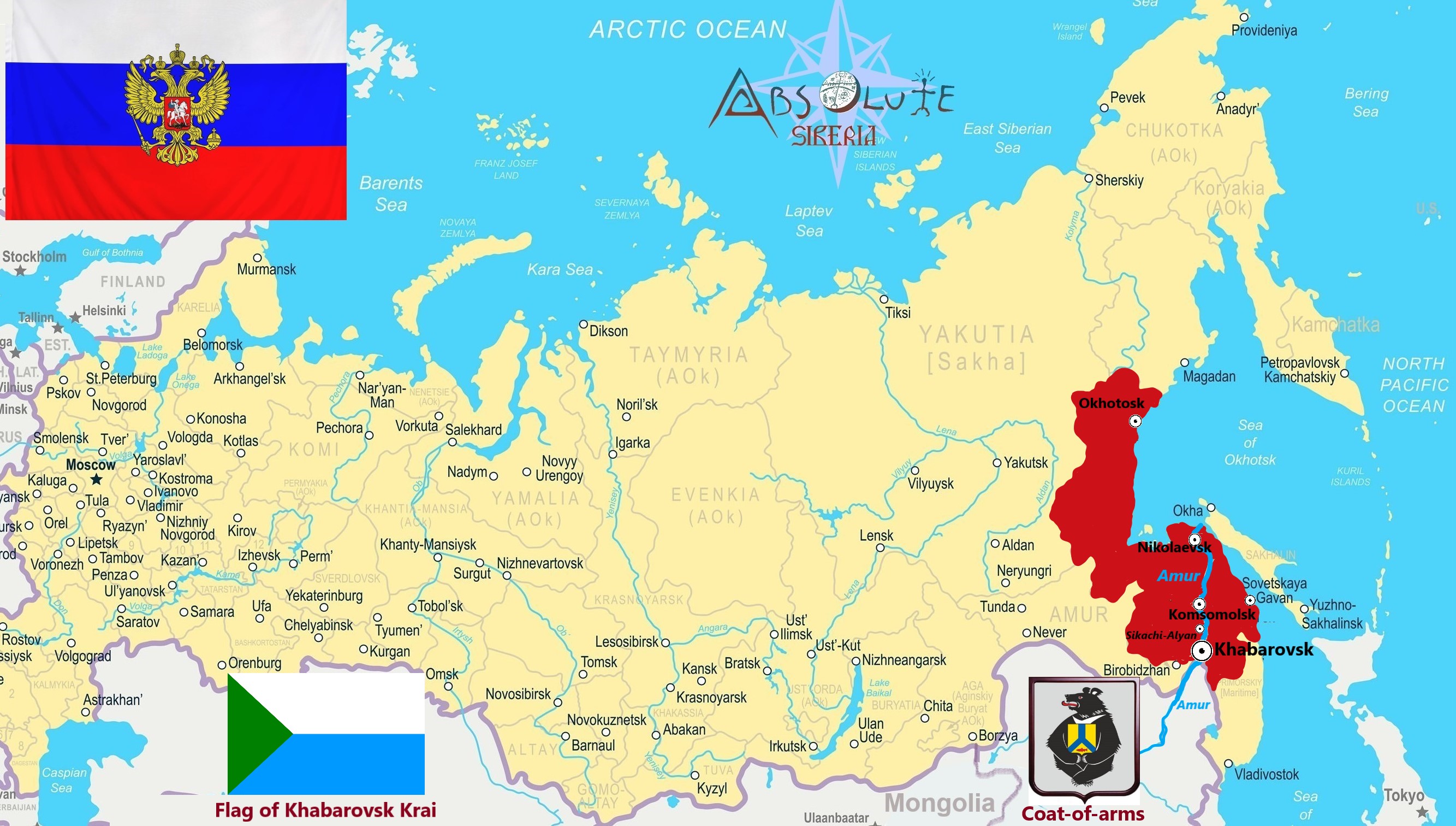
Khabarovsk Krai is located in the eastern part of the Russian Federation. In the north, it borders Magadan region and the Republic of Sakha (Yakutia), in the west - Amur region, in the southwest - the Jewish Autonomous Region and China, and in the southeast - Primorsky Krai. From north-east, the region is washed by the Sea of Okhotsk, from the south-east — by the Sea of Japan. In addition to the continental part, the region includes several islands the largest of which are Shantar islands.The total length of the coastline is about 2500 km, including the islands — 3390 km. CAPITAL: the city of Khabarovsk (founded in 1858, the population 633,000 as for 2020)
AREA: 787 633 km²
POPULATION & NATIONALITIES: 1 333 294 people as for the year 2018, the 55th in Russia by population; National composition: Russians — 91.8%, Ukrainians — 2.1%, Nanais — 0.9%, Koreans — 0.6%, Tatars — 0.6%, other nationaliies — 4.0%.
CLIMATE
HISTORY In the Middle Ages, the territory of present Khabarovsk krai was inhabited mainly by the peoples of the Tungus-Manchu language group. In the 13th-14th centuries, the Mongol rulers of China repeatedly organized expeditions to the lower Amur. The beginning of exploration of the Far East territories dates back to the XVII century. The Russian explorers went to the east to “see the new lands”, bring them under the tsar's government, and establish trade links. Nikolaevsky military post (now the city of Nikolaevsk-on-Amur) which became the main naval base of the country on the coast NATURE PRESERVES / WILDLIFE SANCTURIES
Amurskie Stolby (Amur Rock Pillars) Area 2,482 km2 (958 sq mi) Location: 400 kilometers from Khabarovsk and 15 kilometers from Nizhnetambovskoye village.
The rock pillars are granite columns of various shapes, ranging from 12-70 meters high and located on a hill at a height of 886 meters above sea level.
The silhouette of Shaman-Kamen («Shaman Stone») stands out sharply against the background of the riverside sceneries viewed by the passengers of the few ships that pass along the Amur river. The pillars tower above their According to a Nanai legend from long ago, the daughter of a local shaman, a girl named Adzi (the name of the hill near the Shaman-Kamen), fell in love with a hunter. Despite the daughter's feelings, her father did not approve the marriage. The girl and her beloved escaped. The shaman turned into a bear and chased after the fugitives. The shaman and the hunter started to fight to the death, but the girl, who did not want to see either of them die, stopped time with the help of good spirits. As a result, the shaman, the girl, and the hunter with a dog have remained frozen in time as rocky sculptures ever since. In fact, Amurskie Stolby include many more rock sculptures than those from the Nanai legend. Dusse-Alin Ridge
Area 150 km in length, height is 2325 meters Location: the center of Khabarovsk Krai
The area is unique in its beauty, unusual topography and an abundance of amazing natural objects. The locality is extremely difficult to reach, and part of it is a reserve. All these factors have defined the reputation of this place as a
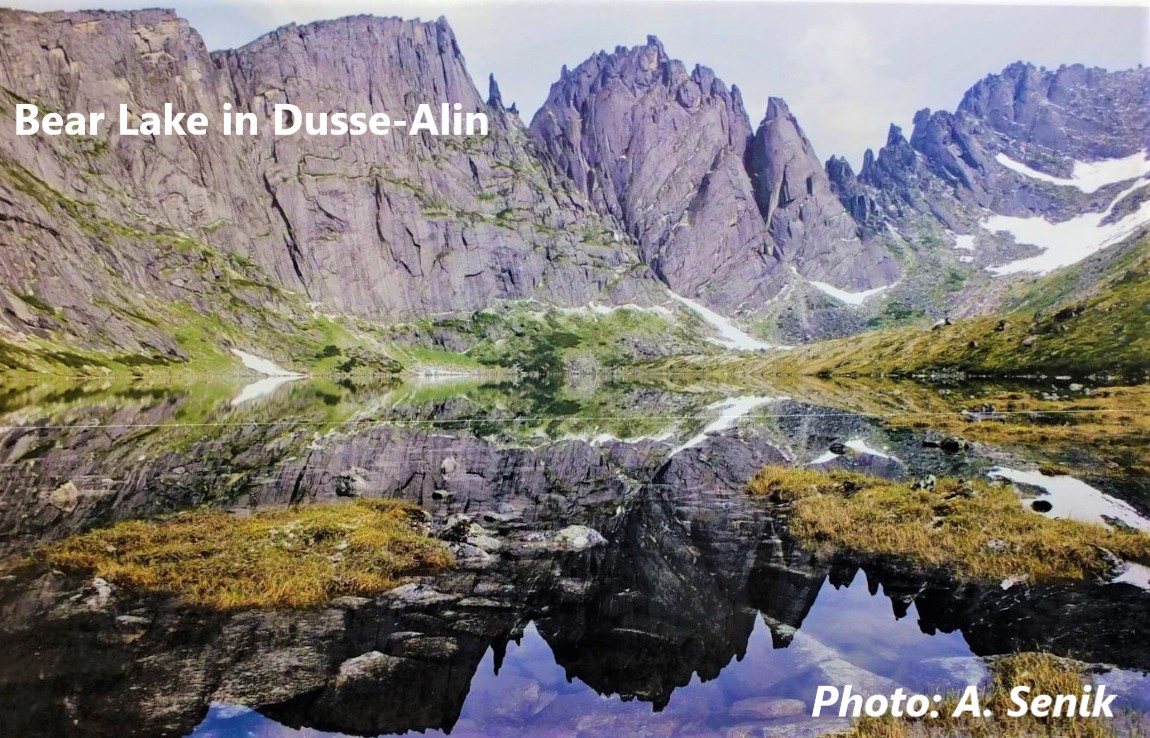 «lost world» of sorts. «lost world» of sorts.The nature of the area is rich and varied — from a unique inhabitant of Lake Korbokhon, to the host of those places, the brown bear. The Dusse-Alin range is one of the most beautiful and highest mountain ranges of the Far East. The range is of interest for those who enjoy the outdoors, and like exploring the nature and unique features of the Far East. The relief of Dusse-Alin is of an alpine nature. There are many beautiful mountain lakes within the range and its gorges, surrounded by beautiful rocky circuses. Mountain springs flow across steep rock ledges, and there are numerous waterfalls. The mountains have sharp ridges and steep rocky slopes. A relatively flat mountain plateau provides effortless access to 1,950 meters above sea level on foot, from where in good weather you can see for tens of kilometers with the naked eye. The magnificent scenery of the Dusse-Alin ridge and its surroundings have a beneficial effect on one's mental state, and the pure mountain air and water serves to enhance the physical condition of travelers. The Bureinsky state nature reserve
Area 358,444 hectares (1,384 sq mi)
The Reserve was set up in 1987. In the south it borders on the Bureinsky Mountain Range and in the east on the Dusse-Alin Mountain Range.
The Reserve includes exclusively primeval forests and mountain landscapes. The lowest point is 550 meters and the highest 2,138 meters above the sea level. The climate of the Reserve is affected by the proximity of the Pacific Ocean and by the continentally of the Eastern Siberia's climate. All these make the climate of the Reserve a northern version of the monsoon one. Farther to the mountains the climate becomes more severe up to the tundra features found in the zone of the bald mountains. 25 species of mammals, including elk, reindeer and musk deer, and rare Manchurian deer and roe deer live on the territory of the reserve. From the predatory animals one can find here brown bear and wolf. There are also can be found wolverene, sable, ermine, mink and sometimes lynx. TOUR SIGHTS OF INTEREST The rich natural potential of the region provides endless opportunities for the development of ecological tourism. You can see reindeer, brown and Himalayan bears, bighorn sheep and even the Siberian tigers on the territory of Khabarovsk krai.
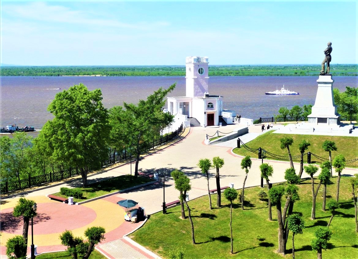
The Amur River is the main attraction of the region. Most of natural, cultural and historical tourist sites are concentrated in the valley of this river.
Museum of the Amur bridge history. The first and main exhibit of the Museum — dismantled during the reconstruction of the farm «Royal» bridge. In 1908, this engineering design with various know-how of the time received a large gold medal at the world exhibition of technical achievements in Paris. There are rolling stock of the late XIX and the first third of the XX century. In the building symbolizing the old station, you will learn a lot about the history of reconstruction of bridges and tunnels of the Far Eastern highway.
Khabarovsk Regional Museum, located in an evocative 1894 red-brick building, contains an excellent overview of Russian and Soviet history, despite not having a single word of non-Russian signage. Galleries take you decade by decade through the past with fascinating propaganda posters, old film clips, audio snippets, black-and-white photos (like the sad crowds gathered at the announcement of Stalin's demise) and rooms with period furnishings and accoutrements that give a taste of what life was like. There's even a small section devoted to the Gulag (fitting, since the nearby prison population was bigger than the city’s in the 1930s). Another section has garments, sleds and carvings of native peoples. The less intriguing new building has a wing dedicated to the Amur River, with live fish in tanks, and more stuffed animals. The North Park (Severny Park) is located at the north-west of the city, some 5-7 km away from the center. It has been recently expanded and restored. It has an intentional romantic flavor, especially the area where the celebration hall is. There the Pushkin Ball takes place every month of June.In the nearby you have the Church of Saint Seraphim of Sarov, worth a visit too if you are in the park.
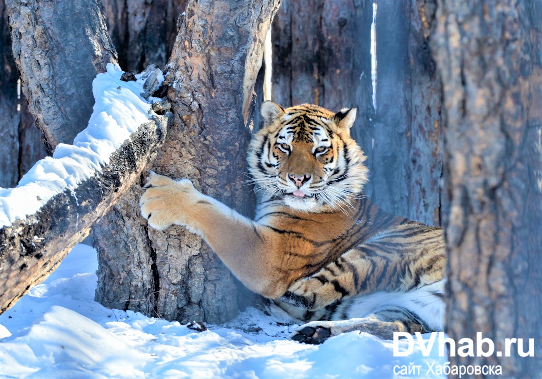
The Amur tiger is the largest tiger of the planet, it is listed under endangered animals. Its body length varies from 100 to 130 cm, the tail is 80 – 100 cm, the grown-up species may weigh up to 300 kg. The Amur tiger is a treasure of the Far Eastern taiga and an object of worship for many indigenous peoples of the Far East. This beautiful exotic colour feline is unrivalled in strength and power in the entire world fauna.
The Ussuri black bear, the white-chested bear, the Himalayan bear. It is also called a tree-climbing bear as contrary to its relatives it actually lives up on trees. The Ussuri taiga is famous with this white-chested bear so its image is depicted on the coats of arms of the Khabarovsky krai and the city of Khabarovsk.The Ussuri white-chested bear is more agile than other bears, the height of a grown-up male reaches usually 2 m, common is 1.5 – 1.7 m, weight close to 150 kg.
The inaccessibility of the islands allowed to preserve pristine nature. Shantar Islands are a habitat of whales, seals, killer whales. It is a great place for fishing. Getting there is not so easy, but if fate has brought you to one of these Islands, the journey will be remembered for a long time. Colorful garland of coastal rocks greets newcomers — they are pink, green, red, white. This is due to the appearance of valuable rocks — Jasper, marble, etc. During the day there you can feel all four seasons. Almost 8 months the Islands are covered with ice, and only by August they cease to melt. There are many endangered birds on these islands, including the Blakiston's fish owl, osprey, black stork, red-necked grebe, gyrfalcon, solitary snipe, Steller's sea eagle and the Siberian grouse.The Kamchatka brown bear (Ursus arctos beringianus), sable and marten, caribou, red fox, and river otter are common on the Shantar Islands. Reindeer can be seen as well. Rivers on these islands are populated by sturgeon, salmon, trout, and various other fish.. Travel to the sea of Okhotsk to visit the Shantar Archipelago (not far from Khabarovsk) where a human population of just seven live cheek by jowl with 200 bears. Meet the killer whales and brave a climate so severe that icebergs linger through the summer and September sees the first snows.
If you wonder to know how the bear became the symbol of Russia? read the article here
Nanai is a small indigenous people, living along the Amur River and its tributaries in Khabarovsk territory - the villages of Djari, Naikhin, Dayerga, and Dada. According to local folklore, the Nanai descended from a taiga tiger and the daughter of the first human couple on Earth. Another perhaps more likely version of events states that the Nanai people came to Russia from China, although experts say that their ethnogenesis is more complex. The Nanai community very ardently preserves their culture. In the villages you may find dozens of national ensembles work: arts and crafts, that are famous far outside Russia. The Nanai worship a sun deity and pray to him until dawn. They also believe in the spirits of their ancestors. Men hunt and fish, while women sew and process animal hide and fish skin. Look on how do Nanai people preserve their unique culture and see their modern way of life here. Click here to read why Native Americans and Siberians are cousins. “Khabarovsk: The city on the 5,000 ruble banknote” What to do and where to go first while visiting the city if Khabarovsk read in the article here ” Khabarovsk: Keystone of the Russian Far East” By rail, the city of Khabarovsk in the Russian Far East is a six-day, 5,300 mile journey from Moscow. Given the distance, it’s unsurprising that most visitors prefer to make the trip by air. The nine-hour flight has the added advantage of giving travelers a dramatic overview of the Amur River on the approach. To continue reading click here
”Two countries, one island Russia and China divided up an island in the Far East in 2004, and here's how life there has changed” Located near the city of Khabarovsk, at the confluence of the Ussuri and Amur rivers, Bolshoy Ussuriysky Island has long held strategic importance for Russia. In 2004, Moscow reached an agreement with Beijing to share the island (known as Heixiazi Island to the Chinese), dividing it roughly in half.
To continue reading click here
|
|
World time
--:-- :--
--.--.--
Our TOURS by CategoryOur Special ServicesSearch
Send an e-mail:
|
language: ENG / RUS
© All rights reserved by Absolute Siberia LTD.
   |
Weather in Irkutsk
Our NEWS 25.02 2015 15.05 2013 Our Associated Organizations
|
||||||||||||||||||||||||||||||||||||||||||
 The climate is continental, with well-expressed monsoon features. Climate conditions change when moving from north to south of the region and depend on proximity to the sea. Winter is long, snowy, and severe. The cold season of the year lasts for about 6 months, from the end of October till the end of April. Mean January temperature is −22 Co in the south and – 40 Co in the north and from −18 Co to −24 Co on the coast. In most of the territory, the summer is relatively warm and humid. Mean July temperature in the south makes +20 Co; in the north it is about +15 degrees above zero. The annual precipitation rate ranges from 400-600 mm in the north to 600-800 mm in the plains and eastern slopes of the ridges. In the south of the region, up to 90% of precipitation falls from April till October, especially heavy rainfall is observed in July and August.
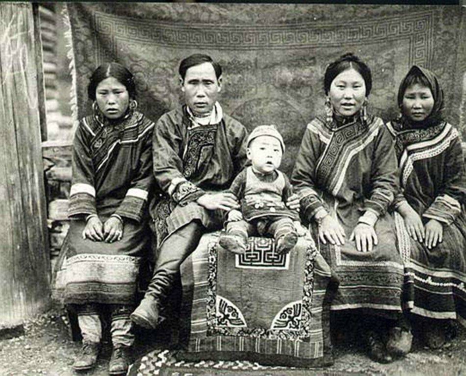 of the Pacific Ocean was founded at the mouth of Amur River in 1850. More than three thousand people including many dissident Old Believers were resettled to Amur region. In 1884, the Priamur Governorate General was formed as part of Transbaikal, Amur and Primorsky regions with the center in Khabarovsk. Under the Soviet government, the territory occupied by these areas was renamed Far Eastern Krai. In 1938, it was divided into Khabarovsk and Primorsky Krais. In 1953, Magadan region left Khabarovsk Krai and formed an independent entity to which Chukotka Autonomous District was transferred from Kamchatka region. The Jewish Autonomous Region left Khabarovsk Krai in 1991.
.jpg) surroundings is like a skyscraper. Coming closer to the rocks, one can find an entire complex of stone structures.
surroundings is like a skyscraper. Coming closer to the rocks, one can find an entire complex of stone structures.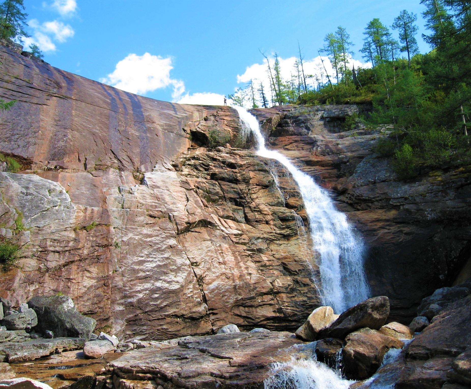 Location: 200 km northwest of the city of Khabarovsk
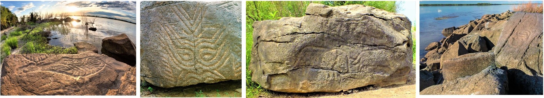 Petroglyphs Of Sikachi-Alyan
 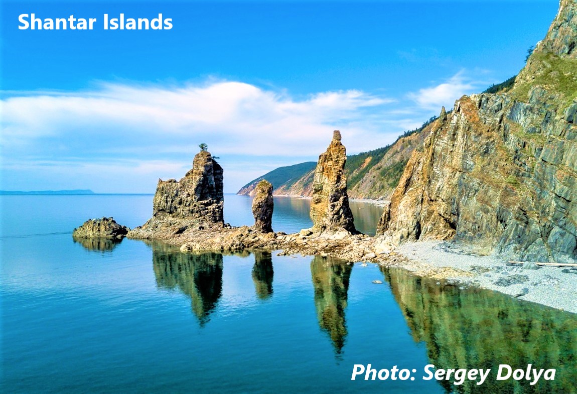 Shantar Islands